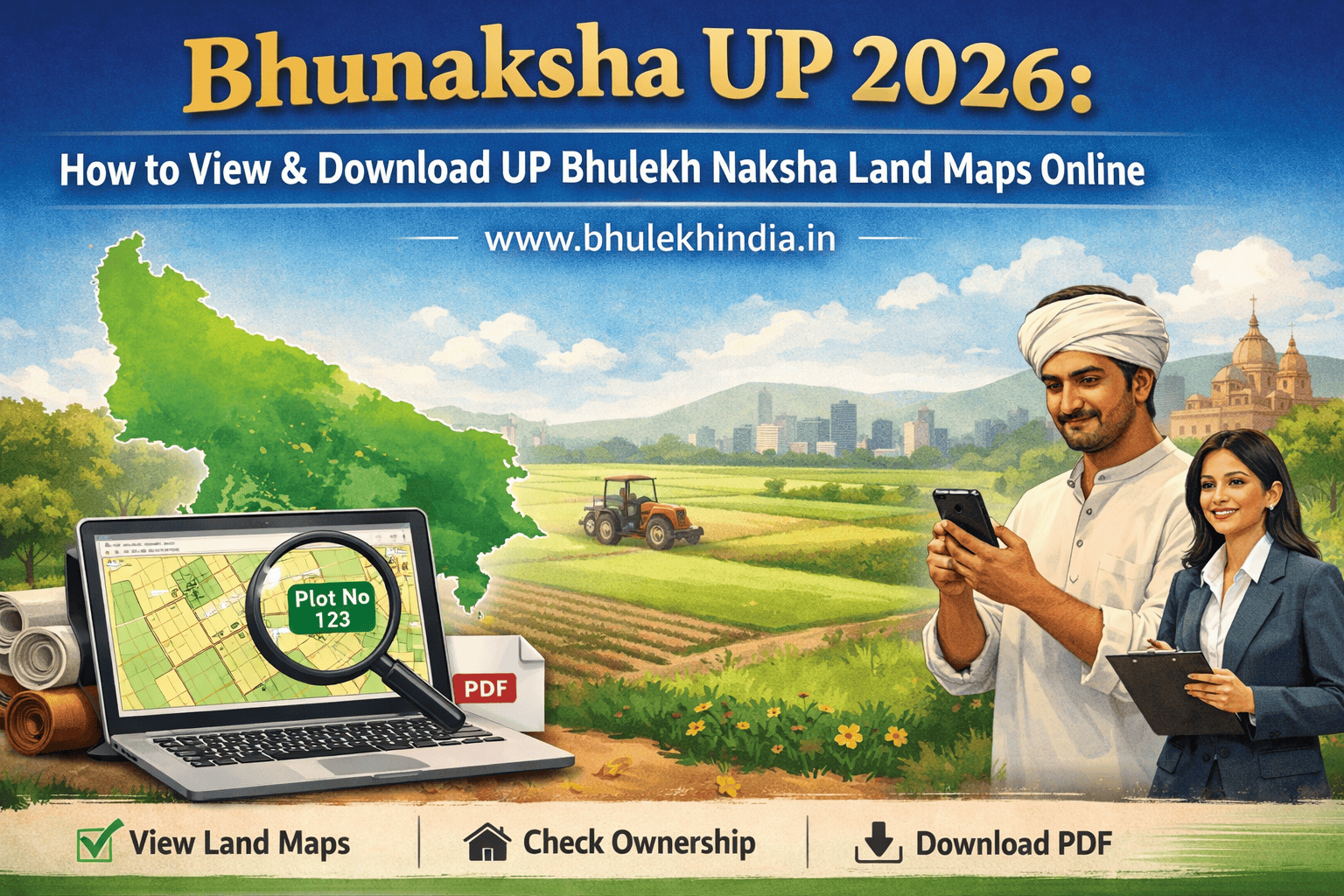
Bhunaksha UP 2026: How to View & Download UP Bhulekh Naksha Land Maps Online
Property ownership in Uttar Pradesh is becoming more transparent and accessible thanks to Bhunaksha UP, a digital platform that allows citizens to view, download, and print land maps online. Whether you are a farmer, buyer, or legal professional, UP Bhulekh Naksha provides instant access to cadastral maps, plot boundaries, and ownership information, making property verification faster, safer, and legally reliable. In this guide, we will explain everything about Bhunaksha UP, including how to use it, its features, and legal relevance.
Many people search for land maps only when they need to verify a property before purchase, resolve a boundary dispute, apply for a loan, or confirm ownership details. In such situations, accessing accurate land information quickly becomes extremely important. Bhunaksha UP helps citizens view plot boundaries and map details online, making it easier to verify land-related information before taking any important property decision.
What is Bhunaksha UP or UP Bhulekh Naksha?
Bhunaksha UP, also known as Bhu Naksha Uttar Pradesh, is an official online cadastral mapping portal developed under the Digital India Land Records Modernization Programme (DILRMP). It provides detailed digital maps of all land parcels in Uttar Pradesh. These maps show plot boundaries, survey numbers, ownership status, and other key land details.
The portal is maintained by the National Informatics Centre (NIC) and the Revenue Department of Uttar Pradesh, ensuring accurate, verified, and government-approved data.
Why Bhunaksha UP is Important
Bhunaksha UP serves multiple purposes:
- Transparency: Reduces land disputes by providing clear boundaries and ownership info.
- Convenience: Access land maps from anywhere via desktop or mobile.
- Legal Support: Maps can be used for property registration, mutation, and legal references.
- Planning & Development: Helpful for farmers, builders, and planners.
- Integration with Bhulekh UP: Shows ownership and mutation data linked to each land parcel.
Official Portals of Bhunaksha UP
To access Bhu Naksha UP, visit:
🔗 https://upbhunaksha.gov.in – For viewing digital land parcel maps
🔗 https://upbhulekh.gov.in – For ownership, mutation, and land record details
These portals are mobile-friendly and accessible across devices.
Objectives of Bhu Naksha UP
✅ Digitize land parcel maps across Uttar Pradesh
✅ Integrate cadastral maps with ownership and mutation records
✅ Reduce property disputes through accurate boundary visualization
✅ Provide easy access to land data for citizens and officials
✅ Support planning, registration, and legal processes
How to Check Bhunaksha UP Online
Here’s how you can access your land records:
- Step: Visit the Portal
- Step: Select Your District
Choose your district from the dropdown list.
- Step: Choose Tehsil and Village
Navigate to your area using administrative divisions.
- Step: Enter Plot Details
Input your plot number or Khasra number to locate your land parcel.
- Step: View the Map
The portal will display your plot on a digital map, showing boundaries and location.
- Step: Access Ownership Info
Click on the plot to view ownership details, area, and survey data.
- Step: Download or Print
You can export the map for legal, agricultural, or planning purposes.
How to Download Bhunaksha UP Map PDF
- After viewing your plot on the map, click “Map Report”.
- Choose “Download PDF”.
- Save the file for legal, agricultural, or personal use.
- You can also export for printing.
How to Print Bhunaksha UP Map
- After viewing your plot on the map, click “Map Report”.
- Choose “Download PDF”.
- Save the file for legal, agricultural, or personal use.
- You can also export for printing.
Key Features of Bhu Naksha UP
| Feature | Description |
| Interactive Map Viewer | Zoom, pan, and click on plots to view details |
| Ownership Integration | Displays landowner names and mutation status |
| Plot Division Tools | Useful for mutation and land redistribution |
| Geo-referencing Legacy Maps | Aligns old paper maps with modern coordinates |
| Multi-platform Access | Works on desktop, mobile, and tablets |
| Print & Export Options | Download maps for legal or planning use |
| Encumbrance Check | Displays loans or legal disputes on plots |
| Multi-search Options | Search by name, plot number, or date |
Districts Covered Under Bhu Naksha UP
Bhu Naksha Uttar Pradesh covers all 75 districts :
| Districts Name | जिलों का नाम |
| Agra | आगरा |
| Aligarh | अलीगढ़ |
| Ambedkar Nagar | अम्बेडकर नगर |
| Amethi | अमेठी |
| Amroha | अमरोहा |
| Auraiya | औरैया |
| Ayodhya | अयोध्या |
| Azamgarh | आज़मगढ़ |
| Baghpat | बागपत |
| Bahraich | बहराइच |
| Ballia | बलिया |
| Balrampur | बलरामपुर |
| Banda | बांदा |
| Barabanki | बाराबंकी |
| Bareilly | बरेली |
| Basti | बस्ती |
| Bhadohi | भदोही |
| Bijnor | बिजनौर |
| Budaun | बदायूं |
| Bulandshahr | बुलंदशहर |
| Chandauli | चंदौली |
| Chitrakoot | चित्रकूट |
| Deoria | देवरिया |
| Etah | एटा |
| Etawah | इटावा |
| Farrukhabad | फर्रुखाबाद |
| Fatehpur | फतेहपुर |
| Firozabad | फिरोजाबाद |
| Gautam Buddha Nagar | गौतम बुद्ध नगर |
| Ghaziabad | गाज़ियाबाद |
| Ghazipur | गाज़ीपुर |
| Gonda | गोंडा |
| Gorakhpur | गोरखपुर |
| Hamirpur | हमीरपुर |
| Hapur | हापुड़ |
| Hardoi | हरदोई |
| Hathras | हाथरस |
| Jalaun | जालौन |
| Jaunpur | जौनपुर |
| Jhansi | झांसी |
| Kannauj | कन्नौज |
| Kanpur Dehat | कानपुर देहात |
| Kanpur Nagar | कानपुर नगर |
| Kasganj | कासगंज |
| Kaushambi | कौशांबी |
| Kheri | खीरी |
| Kushinagar | कुशीनगर |
| Lalitpur | ललितपुर |
| Lucknow | लखनऊ |
| Maharajganj | महाराजगंज |
| Mahoba | महोबा |
| Mainpuri | मैनपुरी |
| Mathura | मथुरा |
| Mau | मऊ |
| Meerut | मेरठ |
| Mirzapur | मिर्जापुर |
| Moradabad | मुरादाबाद |
| Muzaffarnagar | मुज़फ्फरनगर |
| Pilibhit | पीलीभीत |
| Pratapgarh | प्रतापगढ़ |
| Prayagraj | प्रयागराज |
| Raebareli | रायबरेली |
| Rampur | रामपुर |
| Saharanpur | सहारनपुर |
| Sambhal | सम्भल |
| Sant Kabir Nagar | संत कबीर नगर |
| Shahjahanpur | शाहजहाँपुर |
| Shamli | शामली |
| Shravasti | श्रावस्ती |
| Siddharthnagar | सिद्धार्थनगर |
| Sitapur | सीतापुर |
| Sonbhadra | सोनभद्र |
| Sultanpur | सुलतानपुर |
| Unnao | उन्नाव |
| Varanasi | वाराणसी |
Each district includes detailed tehsil and village-level mapping.
Benefits of Using Bhu Naksha Uttar Pradesh
✅ Convenience
Access land maps from anywhere without visiting government offices.
✅ Accuracy
Maps are verified and updated by the Revenue Department.
✅ Transparency
Clear boundaries reduce fraud and disputes in property transactions.
✅ Legal Support
Maps can be used in court cases and mutation applications.
✅ Planning Tool
Useful for farmers, builders, and urban planners.
What Details You Can See on the Map
- Plot boundaries and survey numbers
- Ownership information linked to Bhulekh UP
- Mutation status
- Area and classification of the land
- Adjacent plots and road access
- Legal encumbrances (if any)
Bhunaksha UP vs Bhulekh UP
| Feature | Bhunaksha UP | Bhulekh UP |
| Purpose | Show Cadastral map & plot boundaries | Ownership & mutation details |
| Type | GIS-based digital map | Land record database |
| Legal Use | Reference, planning, verification | Certified document for legal and bank use |
| Online Access | upbhunaksha.gov.in | upbhulekh.gov.in |
| Mobile Friendly | ✅ | ✅ |
| PDF Download | ✅ | ✅ |
How Banks Use Bhunaksha Maps
Banks refer to Bhunaksha UP maps to:
- Verify plot boundaries before sanctioning loans
- Cross-check ownership with Bhulekh UP
- Avoid lending on disputed plots
Common Problems & Solutions
Problems:
- Plot not visible
- Wrong boundaries
- Ownership not updated
Solutions:
- Contact local Tehsil or Revenue office
- Provide proof of ownership
- Request map correction
Errors in Bhunaksha UP & Solution
- Visit local Revenue Office / Tehsil
- Submit an application for map correction
- Attach supporting documents (sale deed, Khasra copy)
- Verification and correction by authorities
Fraud Prevention Tips
- Always use official portals
- Verify Khasra and plot numbers
- Cross-check with Bhulekh UP
- Avoid paying third-party fees
Ensure latest map updates are viewed
Buyer Checklist
Before buying property:
✔ Verify plot on Bhunaksha UP
✔ Check ownership and mutation via Bhulekh UP
✔ Review encumbrances
✔ Inspect land physically
✔ Consult legal advisors if discrepancies appear
Legal Importance of Cadastral Maps
Cadastral maps are essential for:
- Property registration
- Mutation and inheritance cases
- Court disputes
- Agricultural planning
- Infrastructure development
Bhu Naksha UP provides these maps in a digital format, making them easier to access and use for legal purposes.
Conclusion – UP Bhulekh Naksha
Bhunaksha Uttar Pradesh is a powerful tool in the digitization of land records. It empowers citizens, farmers, and officials with accurate, accessible, and transparent land parcel maps. Whether you’re verifying ownership, applying for mutation, or planning a project, Bhu Naksha UP puts vital land data at your fingertips. For certified records and mutation services, use the Bhulekh UP portal. But for visual clarity and boundary verification, Bhu Naksha UP is your go-to resource.
Explore Bhulekh India for state‑wise Bhunaksha land records and maps.
FAQs
Bhu Naksha UP is a digital map portal developed by the Uttar Pradesh government to view land parcel maps, Khasra details, and ownership records online.
Visit upbhunaksha.gov.in, select your district, tehsil, and village, then enter your Khasra number to view your land map.
No. Bhu Naksha UP shows land maps and plot boundaries, while Bhulekh UP provides ownership and mutation records.
After entering your plot details on the portal, click on the “Map Report” or “Print” option to download or save your digital land map in PDF format.
Yes. By selecting your plot on the map, you can view ownership details integrated from the Bhulekh database.
Yes. These maps are verified by the Revenue Department and can be used for land verification and legal reference, though official copies must be obtained from local offices.
The Khasra number is a unique plot number assigned to each land parcel in Uttar Pradesh for identification in land and revenue records.
If your plot is missing or incorrect, contact your local Tehsil or Revenue Department office for corrections or updates.
Yes. The official site upbhunaksha.gov.in is mobile-friendly and works on both Android and iOS browsers.
The maps and records are periodically updated by the Revenue Department as part of the Digital India Land Records Modernization Programme (DILRMP).
Yes, viewing maps and basic details is free.
Read Also:
Explore All Categories: